


COMPANY INFORMATION
PRODUCTS
MY ACCOUNT
Tracks4Africa maps
Tracks4Africa, a company based in South Africa is well known for its GPS maps. These GPS maps are trusted by overland travellers from Cape Town to Timbuktu for its reliability. The secret is that all roads and places on the map were recorded by a large community of overland travellers and this constant updating and verification of the data is what makes Tracks4Africa maps unique.
Now Tracks4Africa has produced paper maps proceeded from the GPS data. These maps are at a large scale of 1:1'000'000. They are cleverly engineered to be used inside your car by folding open only the sections you need.
These maps are the first maps to provide travel times over and above the normal travel distances on paper maps. These travel times are derived from real GPS recordings which are processed to obtain the average travelling speed on roads across Africa.
The Tracks4Africa paper maps are printed on high quality PolyArt paper which is tear and water resistant, making it a perfect material for outdoor use.
Key features of the maps:
- Large 1:1'000'000 scale
- Travel times and distances included on the map
- What you see on the paper map is exactly what you get on T4A GPS Maps
- Comprehensive set of roads and tracks in nature reserves
- Detailed information on camp sites and attractions
- Border crossings indicated with opening and closing times
- Each town is shown with up to date tourist services information
- Printed on tear and water resistant PolyArt paper suitable for outdoor use
Titles
|
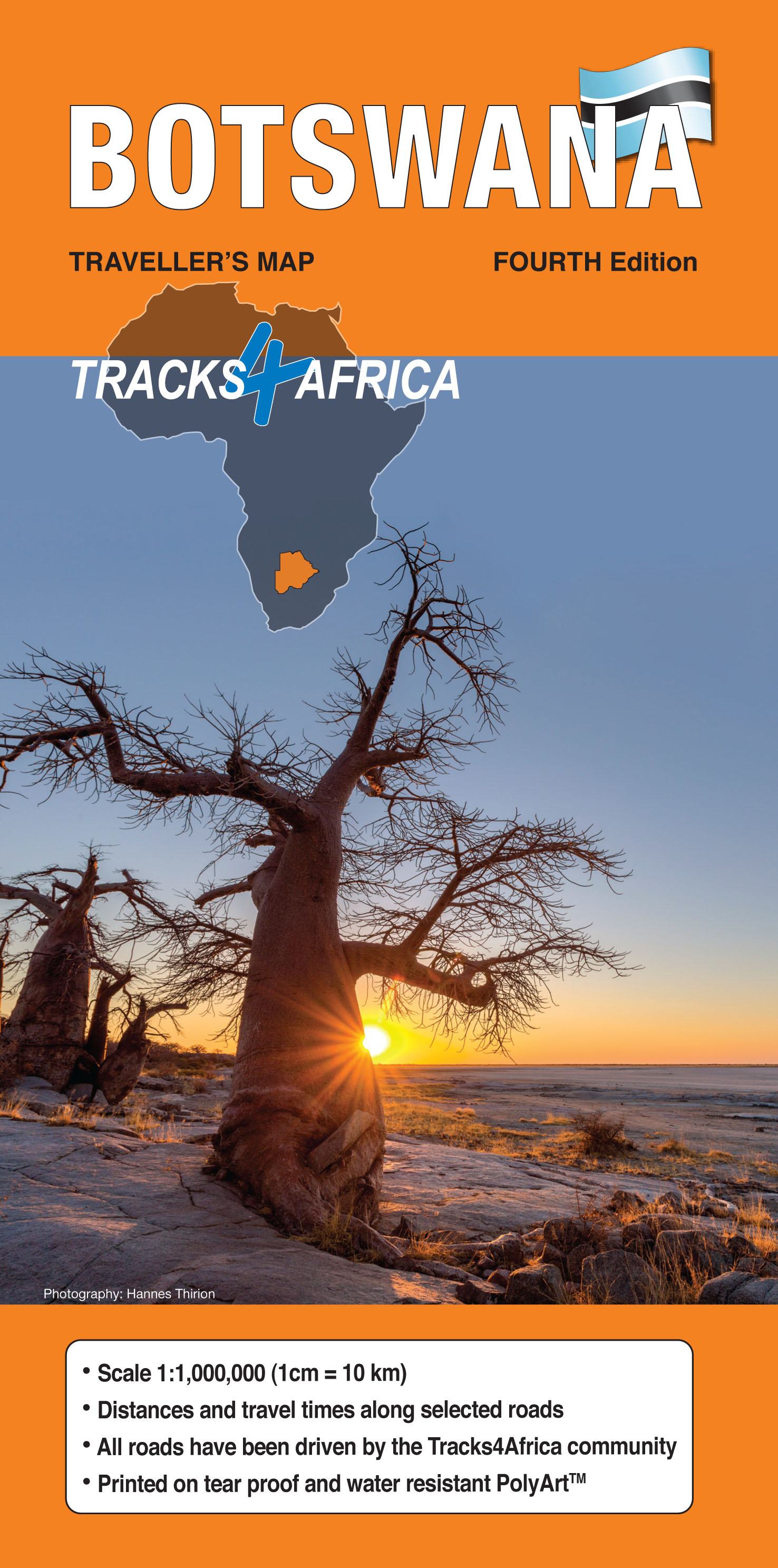
BOTSWANA
The first Botswana tourist map to feature travel times as well as travel distances. The Botswana map is drawn at a scale of 1:1'000'000 and has detailed coverage of all tourist destinations in Botswana, both popular and off the beaten track.
|
|
|
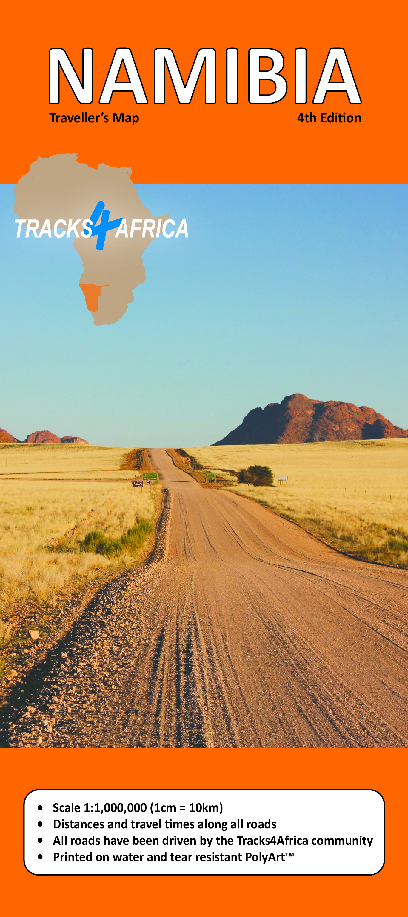
NAMIBIA
The first Namibian tourist map to feature travel times as well as travel distances. The Namibia map is drawn at a scale of 1:1'000'000 and has detailed coverage of all tourist destinations in Namibia, both popular and off the beaten track.
|
|
|
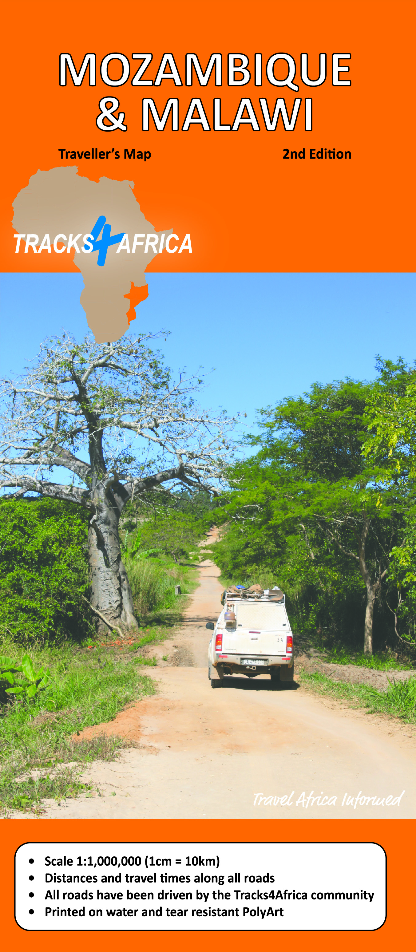
MOZAMBIQUE & MALAWI
The first Mozambique and Malawi tourist map to feature travel times as well as travel distances. The two countries are integrated into a single 1:1'000'000 scale map with lots of detail on tourists destinations and remote places. |
|
|
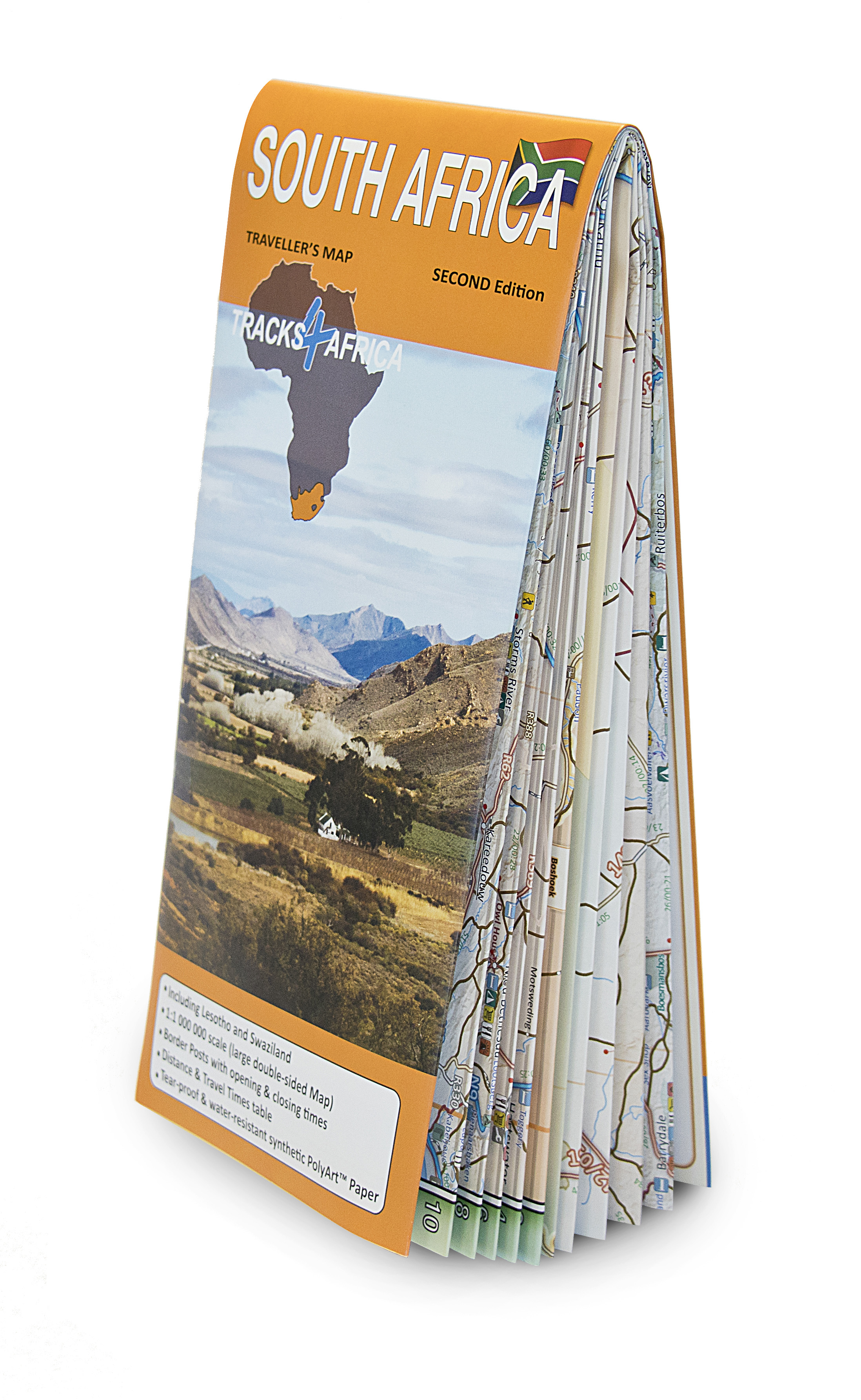
SOUTH AFRICA
The first South Africa tourist map to feature travel times as well as travel distances. The South Africa map is drawn at a scale of 1:1'000'000 and has detailed coverage of all tourist destinations in South Africa, both popular and off the beaten track.
|
|
|
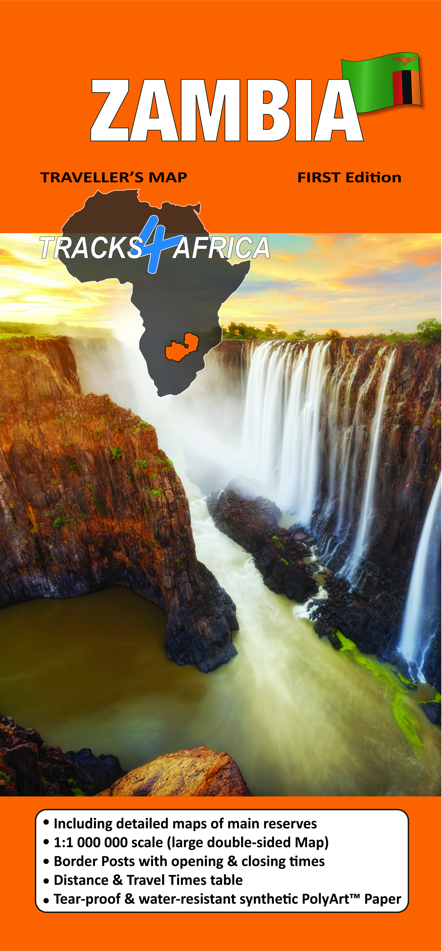
ZAMBIA
This paper map is designed to help you explore Zambia with complete confidence. Whether you are travelling tar roads, gravel roads, or a mixture of both, the Zambia Traveller's Map serves both as a navigational tool and a trip-planning resource.
|
|
Traveller's Atlas
SOUTHERN AFRICA
This Atlas, in A3 size, is specifically aimed at self-drive travellers. Apart from having reliable maps and being well-prepared for border crossings, the self-drive tourist also needs to know where to sleep, get fuel, buy food, get help in case of an emergency and discover what there is to see.
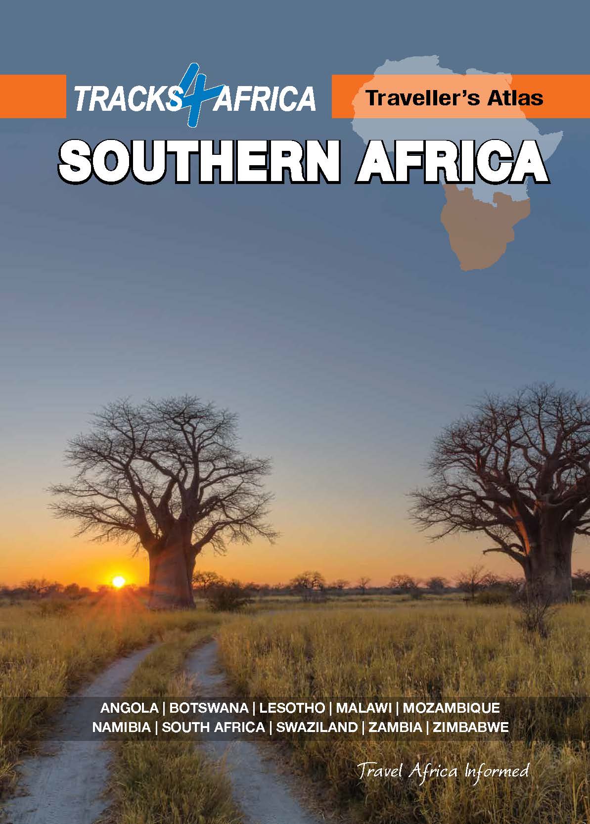
The Atlas is printed in A3 size, has a laminated cover, is wiro bound and the pages are printed on silk matt art paper.
This Atlas covers ten countries in Southern Africa: Angola, Botswana, Lesotho, Malawi, Mozambique, Namibia, South Africa, Swaziland, Zambia and Zimbabwe.
The Atlas features 108 map pages with the same trusted map detail for which Tracks4Africa is renowned.
Map features include:
- All major roads as well as 107170 km of off-road tracks
- Distance and travel time between towns
- Essential facilities available in towns
- Camping and lodging
- 614 Tourist attractions
- All border crossings, with opening times
- All international airports, with IATA/ICAO codes
- 462 Protected areas
The first section of the Atlas includes valuable travel information about each of the ten countries. The information about border crossings and top tourist attractions will help you to be well-prepared for your trip and the sections on driving conditions will assist you while on the road.
Tracks4Africa guides
< Previous
Next >
< Back to overview maps